
Colorer chaque région
L'intensité de la couleur porte la valeur. Le bon choix pour les taux, les parts et les données par habitant, déjà ajustés à la taille ou à la population.
Ouvrir le modèleA blank Michigan county map to print, and a builder to fill it with your own data. Download the free outline of all 83 counties across both peninsulas, or upload a spreadsheet and publish an interactive Michigan map you can embed anywhere.
Les 83 counties, en tracé net. Imprimez-le, coloriez-le ou insérez-le dans un document — sans compte et sans attribution.
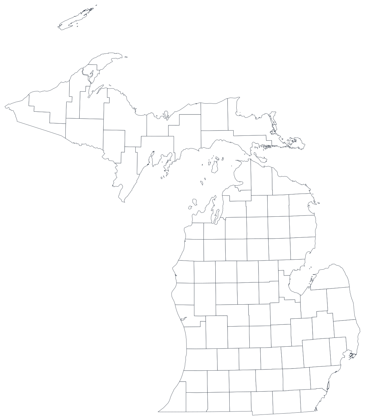
Libre pour tout usage, y compris commercial et scolaire. Généré à partir des mêmes contours que l'éditeur.
Télécharger le SVGMichigan divides into 83 counties spread across two separated peninsulas, and that split is the first thing a map of the state has to cope with. The Lower Peninsula holds almost all of the population, with the Detroit metro counties — Wayne, Oakland and Macomb — carrying a large share of it in three shapes near the bottom-right corner. The Upper Peninsula is roughly a third of the land area and a tiny fraction of the people, so its counties are large, pale and easy to misread. Nearly everything the state publishes — unemployment, school enrolment, health outcomes, election returns, agricultural output — comes out at county level, which makes a county map the natural unit, as long as you remember that a county in the UP and a county in metro Detroit are not comparable things.
Colorez les régions pour un taux, dimensionnez un marqueur pour un effectif. Inverser les deux est la façon la plus courante de tromper le lecteur.
L'intensité de la couleur porte la valeur. Le bon choix pour les taux, les parts et les données par habitant, déjà ajustés à la taille ou à la population.
Ouvrir le modèleUn symbole par région, mis à l'échelle selon la valeur. À utiliser pour les effectifs et les totaux, là où colorer la surface ne ferait que redessiner la carte de la population.
Ouvrir le modèleDes cercles dimensionnés par la valeur, posés sur le tracé. Efficace quand quelques régions dominent et que les petites disparaîtraient dans un aplat.
Ouvrir le modèleMDHHS health indicators, labour figures from the Bureau of Labor Market Information, MDE school data and Secretary of State election returns are all published by county.
Unemployment rate, vaccination share, share of votes, median household income. Rates already account for how many people live in a county, which is what shading a region needs.
Michigan's two clearest stories are geographic: Upper Peninsula against Lower, and the three Detroit metro counties against the rest. Both are arguments a reader can see on a map and has to take on trust in a table.
Classroom exercises, territory planning, colour-by-hand sessions. The free outline above prints cleanly at any size and keeps both peninsulas in one frame.
Shade by a raw count and Wayne County wins every time. Anything that grows simply because more people live there belongs on a sized symbol or bubble, not a shade.
Michigan has well over a thousand townships and hundreds of school districts, and they do not stack neatly inside county lines. Mapping them onto counties will put your numbers in the wrong place.
A map where the entire UP is grey reads as missing data whatever the caption says. If coverage stops at the Mackinac Bridge, say so in the title or drop to the region that is actually covered.
If the point is how Michigan sits against Ohio and Wisconsin, use the US county map or a states map so the reader can see across the border rather than guessing at it.
Du tableur à la carte publiée, étape par étape.
The free outline above is a plain SVG of all 83 counties — print it, or drop it into a document. To build with data, open the PlotSet Michigan (counties) template, which comes with sample data already bound.
One row per county: the five-digit FIPS code or the county name in the first column, your number in the second. Michigan FIPS codes all begin 26.
Import a CSV or Excel file, paste from a spreadsheet, or connect a Google Sheet so the map can be refreshed when the source updates.
Shade the counties for a rate, or switch to symbols or bubbles for a count. Symbols are particularly useful in Michigan, because they stop the empty northern counties from dominating the picture by sheer area.
Sequential for a low-to-high measure, diverging only when a real midpoint exists — the state average, zero change, a 50 per cent line. Four to six steps read more precisely than a smooth gradient.
Publish for a live interactive map with a tooltip on every county, or export a PNG, SVG or PDF for a report or a deck.
Partez du modèle Michigan avec ses données d'exemple, puis remplacez-les par les vôtres.
Ouvrir le modèleÀ quoi doit ressembler la colonne des lieux, et où trouver des données déjà compatibles.
68 in the Lower Peninsula and 15 in the Upper. The template draws them in one frame at their true relative positions, so the Straits of Mackinac gap is real rather than a rendering error.
Saint Clair and Saint Joseph, not St. Clair and St. Joseph. Federal and state tables usually use the abbreviated form, so a name join will silently drop both counties. Joining on FIPS avoids it entirely.
26001 is Alcona, 26165 is Wexford. Store the column as text so the codes keep their shape, and note that the county part is odd-numbered rather than sequential.
The Michigan Department of Health and Human Services, the Bureau of Labor Market Information, the Michigan Department of Education and the Secretary of State all publish county tables, as does the Census Bureau's ACS.
It produces a population map of south-east Michigan every time. Use a sized symbol for counts and keep shading for rates and shares.
The UP is around a third of Michigan's land and a small fraction of its people, so it takes up a third of the map whatever the data says. A cartogram or a sized symbol is fairer when the story is about people.
Saint Clair, Saint Joseph and Grand Traverse are the usual failures, and a mismatch leaves a blank county rather than an error message. Join on FIPS where you can.
A sequence of hues has no natural order, so readers cannot tell high from low without checking the legend on every county. Use one hue, light to dark.
Yes. The outline above is a free SVG of all 83 Michigan counties — right-click to save it, print it, or drop it into a worksheet or document. No account needed.
Importez un tableur et publiez une carte interactive en quelques minutes — gratuit, sans carte bancaire.